- National Security and Strategic Studies
- International Relations/Diplomacy
- Neighbourhood Studies
- Governance and Political Studies
- Economic Studies
- Technological and Scientific Studies
- Historical and Civilisational Studies
- Reflections on PM Narendra Modi's Foreign Policy
- Commentaries & Articles
- Event Reports
- Monographs/Compendiums
- VIF Reports
- Books Reviews
- Annual Reports
- Monthly Reports
- Rare E-Book Library
- Speeches/Transcriptions/PPT
- E-Magazine “Vivek”
- VIF Viewpoint
- VIF - Information Alerts
- VIF Neighbourhood News Digest
- Policies and Perspective
- External Contributors
- Talking Points
- Interactions/Discussions
- Conferences
- Book Discussions
- Positive Bharat
- Questions for Experts
- Vol VII (2024)
- Vol VI (2023)
- Vol V (2022)
- Vol IV (2021)
- Vol III (2020)
- Vol II (2019)
- Vol I (2018)
- Submission Guidelines
- Subscription
- Vision & Mission
- Our Building
- VIF in Media
- VIF Scholars Outreach
- Advisory Council
- Executive Committee
- Distinguished Fellows
- Administration
- Youth Corner
- Vishakha Guidelines


Introduction
North-east India has been witnessing unusually heavy rainfall since the beginning of May. That has resulted in one of the worst floods ever recorded in Assam. As of 3 July, flood has affected 1,835,551 people in 26 out of the state’s 35 districts and it submerged 471.98 square kilometers (47,198.87 hectares) of cropland. [1] About 200 people have died so far. Earlier on 22 June the floods had affected 5,457,601 people in 32 districts and submerged 990.26 square kilometers (99,026 hectares) of cropland. [2] Recurring floods in Assam and their devastating impacts has raised serious questions about the efficacy of current flood adaptation measures that relies primarily on grey infrastructure (or engineering solutions) such as embankments. As floods are projected to intensify as the world gets warmer, a combination of grey infrastructure and green infrastructure (or nature-based solutions) can help Assam and other flood-prone states of India adapt to its impact more effectively in the coming years.
Floods and its Impact on Assam
Assam is one of the most flood-prone states in India and it experiences up to three to four waves of flooding every year. In all, 31,050 square kilometers (3,105,000 hectares) or 39.58% of its total land area is vulnerable to flooding each year. [3] Assam’s vulnerability to flood stems from a complex web of climatic, hydrological and social factors. The state is located in a region that is known for extreme rainfall. For example, while India received an average rainfall of 61.1 millimeters during the first 17 days of the current monsoon season from 1-17 June, the north-east region received 220.3 millimeters, 39% above normal. [4] In contrast, northwest India, central India and southern India reported deficit rainfall of 63%, 57% and 24% respectively. The high density of rivers further exacerbated Assam’s vulnerability to floods. The state has over 125 rivers, a significant numbers of which originated from the hills and mountains of Arunachal Pradesh and Meghalaya (both extreme rainfall hotspots) as well as countries like Bhutan and China. The most well-known among these rivers is the Brahmaputra which originated as the Yarlung Tsangpo in Southwest Tibet. Beyond this, a combination of other factors such as poor or inadequate drainage/channel capacity, high silt load in rivers, encroachment of riverine areas, deforestation/watershed degradation, loss/destruction of wetlands, corruption, etc. have contributed to Assam’s flood woes. Floods have a significant negative impact on Assam’s economy as it loses an estimated Rs. 200 crores every year due to it. [5] This is probably an underestimate and the true economic costs of floods are likely to be many times higher. Furthermore, floods have also washed away 4,270 square kilometers (4,27,000 hectares) of land or 7.40% of the Assam’s total land area since 1950. It continues to wash away 80 square kilometers (8,000 hectares) of land every year. It has also destroyed critical infrastructures that are essential for the maintenance of vital societal functions such as roads, bridges, railway tracks, etc.
Limitations of Current Adaptation Measures
As is the case with other flood-prone states in India, grey infrastructure - so called because it is usually built with concrete - such as embankments (also known as levees or dykes) are the preferred form of flood adaptation in Assam. Embankments are walls constructed along the banks of rivers to prevent flooding. According to reports, since the 1950s, Assam has built 423 embankments along the Brahmaputra River and its tributaries. [6] Of these, 295 are believed to have outlived their intended lifespan. It is therefore not surprising that they are being breached regularly and are even damaged and destroyed. During the post-flood reconstruction phase, government agencies often resorted to simply fixing damaged or destroyed embankments and do not build them back better. As such, they continue to remain vulnerable to future floods. Embankments themselves are also known to exacerbate Assam’s flood problems. For example, floods caused by embankment breaches are often more severe than the regular flooding of rivers and it spread over a more expansive area. Embankments also obstruct flood waters from retreating back into rivers once floods have subsided. Despite these limitations, Assam continues to remain fixated on embankments. One major reason for this is the vested interests of engineers, contractors and politicians for whom embankments are “big business.” Alluding to this, one expertopined that “Assam has increasingly moved towards becoming an ‘embankment economy’ - the construction of embankments along the Brahmaputra has become a business involving contractors for construction, maintenance and repair.” [7] He further lamented that “Floods actually mean a lot of money to a lot of people and many feed off the contractor lobby.” [8]
Rethinking Adaptation
The International Panel on Climate Change (IPCC) observed in the first installment of its Sixth Assessment Report (AR6) that was released on 9 August 2021 that “…the frequency and intensity of heavy precipitation events have increased since the 1950s over most land area” and that “human-induced climate change is likely the main driver.” [9] Thus, as climate change tips toward full-blown crisis, north-east India faces the prospect of more extreme rainfall. For Assam, that meant more intense and severe flooding. In the face of this challenge, a diversified approach to flood adaptation that included both grey and green infrastructures should be explored. In other words, both engineering solutions and nature-based solutions should be a critical part of Assam’s flood defence toolbox. Nature-based solution is an umbrella term that refers to “actions to address societal challenges through the protection, sustainable management and restoration of ecosystems, benefiting both biodiversity and human well-being.” [10] Such solutions may include the following:
- Protecting, restoring or managing natural forests in catchment areas (in upstream/headwaters and along rivers): Upstream forest slows and retains surface water runoff. It also reduces soil erosion and landslides.
- Protecting and restoring wetlands: Wetlands act as natural sponges. They absorb floodwaters during wet periods and release them during dry periods.
- Maintaining or enlarging natural floodplains: Floodplains are natural flooding outlets for rivers and provide more room to spread out.
Implementing these could prove to be challenging because it will require actions to be taken across jurisdictional boundaries. For example, managing floods in the Brahmaputra River effectively through nature-based solutions will necessitate the adoption of a basin-wide approach. That in turn will require greater cooperation and coordination of efforts between Assam, Arunachal Pradesh, Meghalaya and other neighbouring states. However, the priorities, interests and values of these states may not align necessarily and may even be in conflict with each other. But this is not completely insurmountable. Although Arunachal Pradesh andMeghalaya are less vulnerable to flooding than Assam owing to their hilly terrain, they are highly vulnerable to extreme rainfall-induced landslides and mudslides. Given this, it is imperative that Assam and its neighbouring states convene a regional plan to jointly address the challenges of not only floods but also landslides and mudslides sustainably through nature-based solutions.
The ongoing floods in Assam should be seen as a wake-up call that finally galvanizes action on adaptation. Although engineering solutions such as embankments still have a role to play in mitigating floods, they are no longer sufficient. Nature-based solutions therefore have an obvious place in Assam’s flood defence toolbox and provide a powerful complement (or alternative) to engineering solutions. Working alongside engineering solutions, nature-based solutions will boost the overall resilience at all levels of flooding.
[1] “Assam Daily Flood Report as on 03-07-2022 at 4:00 PM.” Flood Reporting and Information Management System (FRIMS). Assam State Disaster Management Authority (ASDMA). July 3, 2022. http://www.asdma.gov.in/pdf/flood_report/2022/Daily_Flood_Report_03.07.2022.pdf [2] “Assam Daily Flood Report as on 17-06-2022 at 4:00 PM.” Flood Reporting and Information Management System (FRIMS). Assam State Disaster Management Authority (ASDMA). June 22, 2022. http://www.asdma.gov.in/pdf/flood_report/2022/Daily_Flood_Report_22.06.2022.pdf [3] Ministry of Jal Shakti, Department of Water Resources, River Development and Ganga Rejuvenation. 2021. “Flood Management in the Country including International Water Treaties in the field of Water Resource Management with particular reference to Treaty/Agreement entered into with China, Pakistan and Bhutan.” Standing Committee on Water Resources (2020-2021). Seventeenth Lok Sabha. Lok Sabha Secretariat. August. New Delhi. http://164.100.47.193/lsscommittee/Water%20Resources/17_Water_Resources_12.pdf [4] Kalita, Prabin. “Northeast rain: ‘Wettest places on earth’ live up to reputation with highest rain in 56 years.” Times of India. June 18, 2022. https://timesofindia.indiatimes.com/city/guwahati/wettest-places-on-earth-live-up-to-reputation-with-highest-rain-in-56-yrs/articleshow/92265984.cms [5] “Assam Losing ₹200 Crore Annually Due to Floods: Economic Survey.”NDTV. August 20, 2014. https://www.ndtv.com/india-news/assam-losing-rs-200-crore-annually-due-to-floods-economic-survey-650610 [6] “Banking on national embankment policy.” The Sentinel. April 5, 2022. https://www.sentinelassam.com/editorial/banking-on-national-embankment-policy-586094 [7] Sharma, Ashima. “The Mising and the Miyah have learnt to live with the Brahmaputra. Can Assam?” The Third Pole. September 30, 2021. https://www.thethirdpole.net/en/livelihoods/adapting-to-brahmaputra-floods-assam-mising-miyah/ [8] Karmakar, Rahul. “In Assam, a trail of broken barriers.” The Hindu. August 2, 2020. https://www.thehindu.com/news/national/other-states/in-assam-a-trail-of-broken-barriers/article32244695.ece [9] International Panel; on Climate Change (IPCC). 2021. “Summary for Policymakers.” In: Climate Change 2021: The Physical Science Basis. Contribution of Working Group I to the Sixth Assessment Report of the Intergovernmental Panel on Climate Change [Masson-Delmotte, V., P. Zhai, A. Pirani, S.L. Connors, C. Péan, S. Berger, N. Caud, Y. Chen, L. Goldfarb, M.I. Gomis, M. Huang, K. Leitzell, E. Lonnoy, J.B.R. Matthews, T.K. Maycock, T. Waterfield, O. Yelekçi, R. Yu, and B. Zhou (eds.)]. Cambridge University Press, Cambridge, United Kingdom and New York, NY, USA, pp. 3−32. https://www.ipcc.ch/report/ar6/wg1/downloads/report/IPCC_AR6_WGI_SPM.pdf [10] International Union for Conservation of Nature (IUCN). 2020. “Ensuring Effective Nature-based Solutions.” Issues Brief. July. https://www.iucn.org/sites/default/files/2022-02/iucn_issues_brief_-_nbs_standard_eng.pdf
(The paper is the author’s individual scholastic articulation. The author certifies that the article/paper is original in content, unpublished and it has not been submitted for publication/web upload elsewhere, and that the facts and figures quoted are duly referenced, as needed, and are believed to be correct). (The paper does not necessarily represent the organisational stance... More >>
- Climate Change
- Extreme weather events
- Assam flood
- climate change adaptation
- nature-based solutions
- green infrastructure

Post new comment
- Web page addresses and e-mail addresses turn into links automatically.
- Allowed HTML tags: <a> <em> <strong> <cite> <code> <ul> <ol> <li> <dl> <dt> <dd>
- Lines and paragraphs break automatically.
More information about formatting options

(Title of the article is taken from the Statement made by Raksha

Reports emanating from the Joint Commanders Conference (JCC) held

The Nepal-China Trans-Himalayan Railway Project, which was propos

Unanticipated but the Taliban have completed their three years in

Introduction Sri Lanka is gearing up for its first Presi
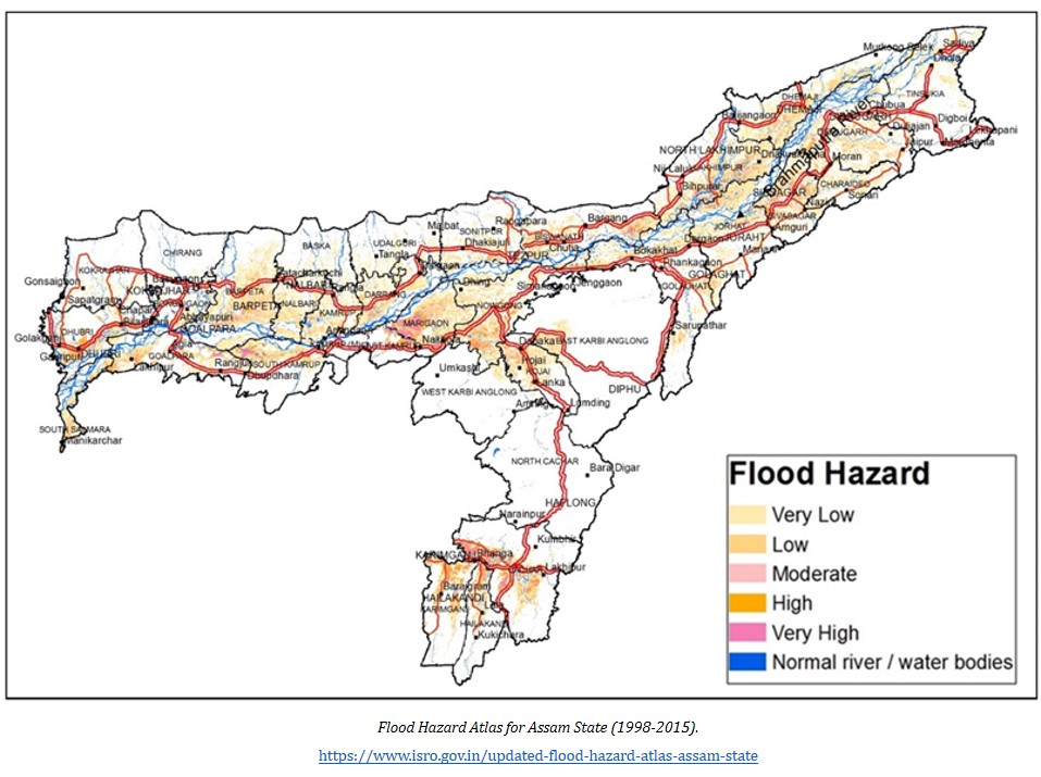
.png "case study recent floods in assam")
The Taliban seized control of Kabul in August 2021, overthrowing

Of late, the Modi government has made a renewed push to further i

Prime Minister Narendra Modi is paying a two-day visit to Singapo
- Español (Spanish)
- Français (French)
- Bahasa Indonesia (Indonesian)
- Brasil (Portuguese)
- India (English)
- हिंदी (Hindi)
- Feature Stories
- Explore All
- Subscribe page
- Submissions
- Privacy Policy
- Terms of Use
- Advertising
- Wild Madagascar
- Selva tropicales
- Mongabay.org
- Tropical Forest Network
Unprecedented flood cripples Assam, massive loss of life and property reported

Share this article
If you liked this story, share it with other people.
- Assam faced two severe waves of flood this year, the first one in May and then again in June, which crippled cities and rural areas.
- Silchar, the second largest city of Assam faced its worst flood in living memory with more than 80% of the city being inundated.
- Assam received excess rainfall in the premonsoon season from March to May this year– 672.1 mm instead of an average of 414.6 mm, the highest in ten years. This is the primary cause behind the devastation, though human-caused disturbances have aggravated the situation.
On the edge of the National Highway 31 in Assam, where floodwater had completely submerged the paddy fields, 43-year-old Rahisuddin was waiting with his wife and five children. Rahisuddin, a resident of Kakoti Gaon, under the Raha subdivision of Nagaon district in the state was waiting for a boat to go back to his village and check on his house. His family, along with most other Kakoti Gaon residents, had left the village after the first wave of flood in May and was now living, with their cattle and whatever belongings they could bring with them, in makeshift camps made of tarpaulins.
He was bargaining with a boatman who was ferrying people at a fare of Rs. 20 per person. “Won’t give anything more than Rs. 10 per person,” Rahisuddin told the boatman. When asked why he was going back to his village now, he told Mongabay-India that he wanted to take a chance to see if the water has receded a bit. “We left the village after the first wave of flood in May and for the last one month, we have been moving from one place to the other. Like most people in my village, I work as a daily wager and catch fish sometimes, but now because of the flood, I don’t have any employment.”
“Initially, we took shelter at Chapormukh railway station as it was not flooded. Then we moved here to the highway for the last 15 days. It is very difficult living like this with my children. So if the situation in the village improves a bit, I will go back to my house,” Rahisuddin said.
When Rahisuddin managed to reach his mud house with a tin roof, he found the rooms flooded with water up to his chest. When Mongabay-India contacted him over the phone the next day, he said it was impossible to stay there. “We are staying near the railway track on the Chapormukh railway station. Hundreds of other families are also staying at the railway station now.”
Rahisuddin and his family are one of the millions who have been hit by this year’s flood in Assam. As per the latest flood bulletin released by the Assam State Disaster Management Authority (ASDMA), 31,54,556 people in 2,675 villages in 26 districts are currently affected. As many as 3,12,085 people are currently staying in 560 relief camps across the state. The death toll so far is 151.

Flood is an annual occurrence in Assam with Rashtriya Barh Ayog (National Flood Commission) calculating 39.58 % of the total area of the state as flood-prone. The state also has 9.40% of the total flood-prone area of the country. Assam faced two severe waves of flood this year, the first one in May affecting parts like Barak Valley, NC Hills and Hojai and then again in June, which crippled most of Lower Assam along with Barak Valley. The pre-monsoon floods impacted rural districts like Barpeta, Nagaon, Morigaon, Nalbari, Kamrup (rural) etc. as well as urban areas such as Silchar, the second largest city of Assam, which had 80% of its area was inundated.
Assam received 62% above normal rainfall in the pre-monsoon season from March to May this year: 672.1 mm instead of an average of 414.6 mm, the highest in ten years. The excess rainfall is behind the devastation with human-caused disturbances aggravating the situation. Assam’s neighbour Meghalaya recorded 93% above normal rainfall in the same season.
Climate scientist Partha Jyoti Das said more data is needed to do event attribution (to climate change) but climate change, as per model projections, is likely to cause more frequent, heavy to extremely heavy, rain episodes in the northeast region. “Therefore, there is a high likelihood that we are already observing extreme rainfall events in our part of the world.”
Bhupen Goswami, former director of the Indian Institute of Tropical Meteorology (IITM) said climate change is definitely a factor contributing to the heightened impacts of the extreme event.

“Earlier, if extreme weather events were happening every 100 years, then now maybe they will happen every ten years. But floods in Assam are also a result of bad management of dams. The flood which is affecting Barpeta and other places of Lower Assam is because of water released from dams in Bhutan and the impact was aggravated by the heavy rain. The meteorological community gave a good forecast this year that there are going to be intense spells of rain. So, keeping that in mind, the release of water from dams should have been planned better,” Goswami told Mongabay-India.
Guwahati under water
Thirty-four-year-old Dhaneswar Das, who ran a paan (betel leaf) shop in the lanes of Rukmini Nagar in Guwahati was unable to open his shop for seven straight days as waist-high flood water had inundated most parts of his lane. Das devised a novel way to sell his stuff and keep his kitchen running during the extreme rainfall event. He built a raft with bamboo and kolgos (banana tree stems) and started selling items like packaged mineral water bottles, candles, match sticks and betel nuts. “Not just me, many other people had come up with such makeshift rafts in our lane. Some people were selling vegetables on these rafts while some people were using them to navigate through the flooded bylanes,” he said.
On June 13, heavy rainfall had hit the city and after a week of continuous rain, a large chunk of Guwahati was submerged. As boats were seen in areas like Rukmini Nagar and Hati Gaon, netizens started dubbing the city “Venice”. On June 19, when Mongabay-India visited Rukmini Nagar, most of the area had waist-deep or knee-deep water. Anup Deka, a resident of Rukmini Nagar said that earlier, the area saw flash floods but floodwater never remained in the locality for such a prolonged period. Deka, who is an auto van driver by profession, said, “I couldn’t take out my vehicle for seven days. The water reached my bed. and I had to send my family away to a safer location.”

While flash floods are not new for the biggest city of northeast India, Guwahati, this year’s deluge exacted a heavy toll. The rainfall also caused severe landslides in many of the hills surrounding the city and in one tragic incident at Boragaon, four construction workers were buried in the debris of their makeshift accommodation. The incident happened on the night of June 13 and a family which was occupying the next room had a close shave. Shivam Sarkar, narrating that ordeal told Mongabay-India, “We heard a loud sound at night and came out and saw large chunks of mud crashing on our room. Next day, the Deputy Commissioner asked us to shift to another location and we have now taken up a rented house elsewhere.”
As landslides were reported in quite a few hills around Guwahati, many people whose homes were destroyed took shelter in the relief camps set up by the district administration.

Engineer J. N. Khatanair, also the technical advisor of Guwahati Metropolitan Development Authority (GMDA), said that unplanned city growth due to heavy human influx with uncontrolled construction activities are the main reason behind flood in Guwahati.
“The present flood experienced in Guwahati is human-caused. Massive unauthorised human habitation taking place in the hill area with deforestation haphazardly taking place has also played a major role in aggravating the flood situation in the city,” he said.
Silchar submerged
Silchar, the second most populous city of Assam after Guwahati, resembled a set from a disaster movie, with more than 80% of its area submerged since last week. Like Guwahati, Silchar residents are also not alien to flash floods triggered by heavy rainfall.
However, when the water level started increasing on June 21, nobody in Silchar had even imagined what was to follow. On June 22, almost the entire city was inundated. While the rainwater from neighbouring hilly states like Manipur and Mizoram added to the flooding, breaching the Bethukandi dyke on Barak river was primarily responsible for Silchar’s fate.
“My father suffers from hypertension and needs his blood pressure medicine daily. However, stock of one of his medicines finished, and it had to be procured anyhow. There is a pharmacy hardly 200-300 meters from our residence, but no pharmacy nearby was open that day. My brother had to wade through 5-6 km of chest-high flood water before finally finding a pharmacy and my father’s medicine,” recounts Nilotpal Bhattacharjee, whose family lives in Kanakpur, a severely affected locality in Silchar.
Thirty-four-year-old Bhattacharjee, an academic and journalist currently in Tezpur, is having sleepless nights worrying about his aged parents and younger brother back home. Silchar’s residents have questioned the government for the lack of timely intervention.

“Despite having information, the government didn’t repair that embankment,” said Krishanu Bhattacharjee, who is also the convenor of the Silchar Chapter of India March for Science. He further said it is the need of the hour to make wetlands near Silchar like Mahisha Beel and Malini Beel encroachment free. Cachar Cancer Centre, the premier cancer facility in Barak Valley, established in 1996, also faced a major problem when the campus and parts of the hospital building were waterlogged.
Speaking to Mongabay-India, Kalyan Chakraborty, founder and Chief Administrative Officer of the hospital, told Mongabay-India, “The entrance of the hospital is flooded, so we are transporting patients on makeshift rafts. Currently, 140 patients are admitted to the hospital along with 200 staff. We are grateful to the administration and civil society for helping us with supplies so that we could take care of all these people.”
H. P. S Kandari, Commandant of 1st Battalion of NDRF, told Mongabay-India that the magnitude of the flood combined with the city’s large population was scuttling disaster response efforts in Silchar. “We have 22 units in Assam, of which nine are in Silchar. In some areas, the current is too strong. Maintaining our equipment is sometimes difficult because we don’t know what is beneath when we ply our boat in these waters. So, sometimes our boats get punctured. We have mobile workshops to repair such damage though it is not always possible to send mobile workshops everywhere at such short notice. We are working without rest in this situation to ensure we can reach everyone needing help.”
No respite in rural Assam
On a portion of the road which connects Nagaon district’s Raha to Jakhalabandha, one can see a cluster of small tents that have now become the home of Podumoni and Kakati Gaon village residents. Hafizuddin, who came from Podumoni, has been living with his family of ten in a small tent for the last ten days that he had never seen such a devastating flood before. “This is bigger than 2004 (flood),” he said.
The village residents say their houses were submerged because water was released from three dams- Umrangshu, Karbi Longpi and Khendong. Not just the village residents, but many government officials have also been unable to return home after the floods.

Parishmita Saikia, Flood Officer at Raha Circle Office, has been living in her office for the last 15 days. “My house is 7-8 km from Raha. I have heard that water has also entered my house, but I have been unable to go to check on my parents. I have to stay till three at night because there is so much paperwork involving the relief work. There is a colleague’s house nearby where I go and freshen up sometimes,” said Saikia.
The NDRF is assigned the task of sending relief to some of the worst affected areas. Mongabay-India encountered one such team at Raha. Inspector Milan Jyoti Hazarika, who was leading the team, said that while he hails from Lakhimpur, known for its floods, the event he witnessed this year will be unmatched for its intensity. “In Chapormukh, we rescued people whose houses were completely submerged, and somehow they had taken shelter on the roof,” Hazarika said.
Sofiqul Islam, who conducts boat clinics at the chars or riverine islands of Barpeta district, said that in Lower Assam, the havoc was mainly created by the swollen tributaries of the Brahmaputra like Jiabharali and Pagladia. He also expressed concern over waterborne diseases affecting the flood victims once the floodwater recedes.
Criticising the government approach towards flood management in the region by constructing embankments, independent researcher Mirza Zulfiqur Rahman said, “Flood management in this region means constructing embankments which are nothing but merrymaking for contractors. Since the 1950 earthquake, we are constructing risks (embankments and dams) in the landscape without properly mapping the floodplains. Even small dams like Kopili, Ronganodi and Umrangshu can create huge havoc.”
“If you remove even one boulder from the river bed, it will have an impact. These boulders act as cushions, and the floodwater will come in much higher intensity in their absence. The interventions we are doing on the ground can lead to catastrophic events. Entire northeast India is sitting on a veritable pack of cards, ready to collapse. The way this government responds to climate change shows that they are not even keen to acknowledge this issue. They are piling double the infrastructure of what our landscape can absorb,” Rahman added.

The Assam State Disaster Management Authority (ASDMA) has plans like developing climate-resilient villages to combat floods. Elaborating on this, Mandira Buragohain, Project Officer (Knowledge Management and Climate Change), ASDMA said, “We are planning to come up with climate-resilient villages in Assam which will have a raised platform, handpump built on an elevated structure, community cowsheds and also we will do capacity building of women and youth. We will be setting up flood shelters in Bihpuria, Majuli and Barpeta where around 500 people can take shelter.”
When asked if the challenges are more this time, she said, “2020 was also very challenging because along with the flood, there was also a raging pandemic. However, this year the flood is more intense.”
Banner image : A shop set on a raft in Guwahati. Assam has 9.40 percent of the total flood-prone area of the country. Photo by Nabarun Guha.
Climate Innovations

Polluting leather industry adopts sustainable practices to reduce environmental footprint

Brick kilns embrace zigzag design to cut pollution and boost efficiency

Innovating with deadstock: From dump yards to designer racks

Innovative air-to-water tech using liquid desiccant makes affordable, renewable water
If the Green Revolution rode on the strength of chemicals derived mainly from fossil fuels, now there is a shift in the thinking on how agriculture is being done in India, with a thrust on growing indigenous crop varieties and following natural farming practices. In the industrial sector, with initiatives such as ‘Make in India’, […]
Free and open access to credible information
Latest articles.

Your Environment This Week: Indian savannas, secret lives of small cats, food insecurity in the Himalayas

[Interview] Vigyan awardee Purabi Saikia on the importance of mapping forest resources

Operation Bhediya reveals gaps in human-wildlife conflict mitigation

A new remote sensing study spotlights Indian savannas

Capturing the secret lives of small cats

[Explainer] What is micro irrigation?

Multiple studies flag food insecurity as a threat in the Himalayas

New urban governance bill in Bengaluru faces criticism, takes away citizen power says analysis
Academia.edu no longer supports Internet Explorer.
To browse Academia.edu and the wider internet faster and more securely, please take a few seconds to upgrade your browser .
Enter the email address you signed up with and we'll email you a reset link.
- We're Hiring!
- Help Center

Disaster recovery and resilience: Case study of Assam floods, India

Often recovery actions and initiatives provide a window of opportunity to instill changes and influence transformational changes as well. However there is limited documentation of recovery actions and their impacts in the face of recurring disaster events such as annual floods and riverine erosion. This case study research of Assam floods in India was undertaken using participatory research tools and key informant interviews to explore the promoting and prohibiting factors to build resilience of the communities suffering from recurrent floods and erosion. This study explores how communities recover from repeated disaster events, what support do they receive, what are the challenges faced by them, and their resultant coping or adaptive strategies. It was found that communities suffering from erosion and floods keep losing land and assets gradually and receive minimal support for recovery. Although the humanitarian emergency programmes and early recovery interventions exist for very limited timescale, using integrated and participatory approaches were found to promote community resilience. It was found that community participation, knowledge transfer, technical and financial assistance, and the critical assistance to vulnerable groups were instrumental in recovery processes. This paper presents evidence for understanding of community resilience when faced with disasters irrespective of the scale, and the role played by institutions in enabling these recovery processes. The emerging recommendations advocate for a stronger role of civil society and NGOs in Assam for lobbying and developing a state-level and national consensus on the issues of embankments as flood protection measures, recognizing of riverine erosion as a disaster and recurring floods as a national problem.
Related Papers
Sneha Krishnan , Bipul Borah
Early recovery work provides a useful opportunity to promote community resilience. This paper describes the nature of recovery and the contextual analysis under which the project funded by ECHO for early recovery1 post- floods was undertaken in Assam, the northeastern region of India in 2012-13. Oxfam India, as part of a consortium with two other International agencies began their early recovery interventions after the immediate response. However, due to multiple waves of flooding most agencies faced innumerable challenges during their response interventions. This paper provides a narrative of opportunities and challenges faced in promoting community resilience through recovery work, by making conscious attempts and visionary interventions focussing on longer-term development. The lessons from this early recovery programme are instrumental not only for WaSH/ sector-specific programming but also useful for addressing future risks, informing policy and promoting resilience.
Sneha Krishnan , Giuseppe Forino
Repeated occurrences of disasters pose a huge threat to community and infrastructural resilience. Hence recovery processes should go beyond the traditional notion of bouncing back and restore normalcy, but should strive for a change or transformation, which will prepare the affected communities to face future hazards. This study particularly looks at the different approaches in water, sanitation, and hygiene in post-disaster recovery, which can promote disaster resilience and assesses their effectiveness using a resilience framework focusing on learning, participatory processes and capacity development initiatives during recovery. The qualitative case study method was adopted and empirical evidence gathered in the recent floods in Assam, India in 2011. The framework was validated using a set of indicators, which were tested over a period of time, and triangulated with the inputs from experts through qualitative interviews. The findings from this research, based on visits to the study site so far have highlighted WaSH as a priority in both emergency and longer-term recovery efforts. Some of the structural measures include installing new tube wells over the flood danger level, construction of latrines, raising platforms while reconstructing previously damaged hand pumps, increasing the plinth level, and non-structural measures under hygiene promotion include promoting the use of latrines, hand washing, safe food hygiene and water hygiene practices. The processes followed in villages that are frequently flooded were found to be inclusive and lead to learning and integration. Hence the resilience components could potentially lead to transformative recovery.
Sneha Krishnan , John Twigg
Repeated occurrences of disasters pose a huge threat to community and infrastructural resilience. Hence recovery processes should go beyond the traditional notion of bouncing back and restoring normalcy, and should strive for a change or transformation, which will prepare the affected communities to face future hazards. This study particularly looks at the different approaches in water, sanitation, and hygiene in post-disaster recovery to promote disaster resilience and assesses their effectiveness. Using the case study approach, evidence is gathered from the recent floods in Assam, India in 2011. A resilience framework conceptualised through a literature review, and with input from experts through qualitative interviews, will be validated using a set of indicators through an empirical study that was conducted over visits at three different periods of time. The first two visits were conducted for an emergency assessment and a scoping study during the early recovery phase. The participatory appraisal tools were used for collecting information through affected members of the communities and various stakeholders and were complemented using documentation through photographs and field notes. The preliminary findings based on brief visits to the study site so far have highlighted water, sanitation and hygiene (WaSH) as a critical need and priority during the emergency, early recovery and longer-term recovery efforts. Some of the structural measures undertaken include installation of new tube wells over the flood-levels, construction of latrines, construction of raised flood platforms while reconstructing previously damaged hand pumps, increase of the plinth level, and non-structural measures under hygiene promotion include promotion of the use of latrines, hand washing, safe food hygiene and water hygiene practices. The processes followed in villages that are frequently flooded were found to be inclusive, leading to learning and integration. Additionally, through institutional capacity building, recovery processes could potentially lead to transformational changes.
Garima Aggarwal , Sanjay Agarwal
This study elaborates on thephysical and socioeconomic impacts of catastrophic disaster like floods due to limitedability to respondto disasters. Using thecase of recent flood occurred in Jammu and Kashmir, the paper foregrounds how communities are marginalized inevitably to bear the repercussions of fulfillment of their needs in the post-disaster relief and recovery phase. This happens not necessarily due to natural hazard but also because of deficient disaster recovery process. The study highlights the role of flood recovery management planning as a tool for resilience not only to facilitate sequenced post-disaster reconstruction and rehabilitation but also to provide an opportunity for sustainable development by “rebuilding better”.
Anoradha Chacowry
At the global level, a noticeable rise has been observed in the adverse impact of an increasing number of hazards, in particular floods, on society. This condition has brought into greater focus the issues of vulnerability, environmental justice and resilience in the recovery of community groups. In Mauritius, economic development, growth in population and intensive land use have resulted in greater human use-environment interaction with accompanying increase in flood conditions and the vulnerability of inhabitants exposed to flood risk. Traditional top-down hazard risk reduction strategies have not been very effective in reducing vulnerability or in promoting resilience of affected communities as they are often left to fend for themselves immediately after the emergency and relief stage of the recovery process. Using three case studies, this thesis explored the perception of the affected communities in building resilience to recover in the aftermath of flood hazards. Mixed methods ...
Eastern Geographer
SUBHRAJIT RATH
Community resilience against natural disasters assumes a lot of importance in policy circles. Natural disasters not only disrupt the foundation of overall economic processes, they also affect different groups of victims differently. In this paper, we have made an attempt to present how the socioeconomic variations dictate the differential impacts of natural calamities on people living in a disaster prone area, taking Uttarakhand disaster 2013 as a case that caused a loss of substantial material and life in Uttarakhand state of India. The case study is based on 652 sample respondent households of four disaster affected districts of the state namely; Chamoli, Pithoragarh, Rudraprayag and Uttarkashi. For the sake of comparison, Dehradun is taken as a controlled district. The paper makes a conscious effort to analyse the differences in losses to communities owing to their caste, educational attainment, income class and occupational trades. With the help of both primary and secondary information, the paper highlights significant differences in losses incurred by different community groups. The resilience against the disaster was found to be high for the upper caste and affluent groups compared to the marginalized communities.
The Australian journal of emergency management
Dr. Yenny Rahmayati
Disasters contribute to the complexity of urban problems such as water and sanitation, waste management and infrastructure damage. For some countries illegal settlements, slum areas, urbanisation, internal migration and employment dislocation exacerbate these problems. A common urban disaster that occurs in many Asian and Pacific countries is flooding, especially during the rainy season. Floods in Jakarta affect vulnerable communities situated on the riverbank of the Ciliwung River. Temporary shelters have been used in response, but they have not answered the needs of these communities. While many studies argue that socio-economic factors are significant contributors to community resilience, this study found that cultural and historical connections, 'connecting to place', was a significant factor that helps people survive and adapt. As such, relocating communities to safer locations is not always the answer and may contribute to other problems. This study supports designs fo...
Vina Ismawati
International Journal of Population Studies
Biswajit Mohanty
Globally, natural disasters have caused a large scale of damage and destruction every year, affecting millions of people, the economy, and development – and developing countries are the most severely affected. Odisha is one of India’s most disaster-prone states. This study explores the effects of, and resilience to, cyclones, floods, droughts, and heatwaves in Odisha, and identifies government strategies that help mitigate these natural disasters. We mainly used primary data collected through a qualitative study undertaken from April 2017 to June 2017 in three districts of Odisha. We conducted in-depth interviews and focus group discussions with community members and key stakeholders at different levels. In addition, our study analyzed secondary data on natural disasters using DesInventar, a disaster information management system data source. The findings show that floods, cyclones, and drought in recent years, along with heatwaves and lightning, have severely affected the people of...
Loading Preview
Sorry, preview is currently unavailable. You can download the paper by clicking the button above.
RELATED PAPERS
Somporn Khunwishit
International Journal of Social Work and Human Services Practice
World Rural Observations, Marsland Press, USA
MD A S H I K SARDER
Madhuri pratap
International Journal on Advanced Science, Engineering and Information Technology
Devina Khoirunnisa
Venkat Pulla
International Journal of Research -GRANTHAALAYAH
WAREBI BRISIBE
Environment and Urbanization
Tania López-Marrero
Chandrani B Neogi
kate crinion
Journal of Environmental Management
Emdad Haque
Environmental Hazards
Mahed Choudhury
Dr. Duncan O . Ochieng
Pooya Alaedini
European Proceedings of Social and Behavioural Sciences
ngai weng Chan
Rabin Sharma
DISASTER GOVERNANCE AND COMMUNITY RESILIENCE: THE LAW AND THE ROLE OF SDMAs
Natasha goyal
TARI EYENGHE
Achmad Room Fitrianto
Karen Sudmeier-Rieux
francis opiyo
European Scientific Journal, ESJ
Bupinder Zutshi
RELATED TOPICS
- We're Hiring!
- Help Center
- Find new research papers in:
- Health Sciences
- Earth Sciences
- Cognitive Science
- Mathematics
- Computer Science
- Academia ©2024
Content Search
Situation report 2: flood situation in india (18 july 2024).
- Sphere India
Attachments

Date: 18th July 2024 (Tue) Time: 10:00 AM (IST)
SITUATION UPDATE
The state has been experiencing a flood situation since June 25, 2024, due to heavy to very heavy rainfall and the rising water levels in various rivers.
On July 17, 2024, a total of 16 districts and 49 revenue circles have been affected by the flood, including Biswanath, Cachar, Dhemaji, Dhubri, Dibrugarh, Goalpara, Golaghat, Hailakandi, Kamrup, Kamrup Metro, Karimganj, Majuli, Morigaon, Nagaon, Nalbari, and Sivasagar.
According to the IMD report, the highest rainfall recorded in different districts during the last 24 hours was 120 mm in Cachar and 80 mm in Tinsukia, with an average rainfall of 21.1 mm.The Central Water Commission (CWC) bulletin indicates that the Brahmaputra and two other rivers are flowing above the danger level.
One human life was lost in the last 24 hours, bringing the total number of deaths to 113 during the current flood.
A total of 3,337,981 people have been affected so far. Dhubri is the worst hit in the last 24 hours with nearly 80,000 people impacted, followed by Nagaon with 77,500 people and Cachar with almost 72,000 people.
The flood has caused significant damage to infrastructure, with 24,501 houses reported damaged (3,306 fully and 21,195 partially).
Eighty-four relief camps have been opened, accommodating 15,476 inmates. Additionally, 85 relief camps and relief distribution centres are operating in eight districts, caring for 24,336 displaced people.
A total of 823 villages are underwater, and 16,673.86 hectares of crop area have been damaged across the state.
Embankments, roads, bridges, and other infrastructure have been damaged by floodwaters in Bajali, Goalpara, Kokrajhar, Bongaigaon, Dhubri, Barpeta, Charaideo, Dhemaji, Dibrugarh, Golaghat, Jorhat, Kamrup, Karimganj, and Morigaon.
Essential services such as road communication, telephone communication, water supply, and electricity supply have been affected in flood-affected districts.
The state of Uttar Pradesh has been experiencing a flood situation since July 7, 2024, due to heavy to very heavy rainfall, including extremely heavy rainfall, and the rising water levels in the rivers.
According to the IMD report, no rainfall has been reported during the last 24 hours in the state.
As per the Central Water Commission (CWC) bulletin, the rivers Kwano, Rapti, and Bhuri Rapti are flowing above their danger levels in different districts of the state.
So far, around 80 human lives have been lost during the current flood.
In the past 24 hours alone, 10 people were killed in rain-related incidents, including three each in Moradabad and Gorakhpur, and one each in Pilibhit, Lalitpur, Ghazipur, and Etah.
A total of 13 districts in the state are flood-affected, including Lakhimpur Kheri, Kushinagar, Shahjahanpur, Barabanki, Siddharthnagar, Ballia, Gorakhpur, Unnao, Deoria, Hardoi, Ayodhya, Budaun, and Maharajganj.
In the last 24 hours, 413 villages and 338,082 people have been affected by the flood.
So far, 20 districts, 1,625 villages, 1,522,778 people, and 324,528 hectares of crop area have been affected during the current flood in the state.
Over 11,000 people have been rescued, and more than 11,962 individuals have been relocated to safety in just ten days.
In total, 804 shelter homes were set up in the state, and currently, 1,365 individuals are staying in these shelter homes after being displaced.
In Balia, 180 families affected due to erosion and washing away of few settlments. Awareness have been done, pamphlets distributed.
Heavy rains continued to lash several parts of Kerala, especially the hilly areas of its northern districts, on Thursday, disrupting normal life. Incidents of flooding, uprooting of trees, and minor landslides have been reported from many parts of northern Kerala districts.
In the hilly areas of Wayanad district, widespread heavy rains have caused significant disruption. A total of 29 houses have been partially damaged, and 1002 people have been shifted to 26 relief camps. Additionally, there has been a rise in the water levels of rivers flowing through the region.
Three people died in Kerala on Wednesday as heavy rains continued to pound many parts of central and northern Kerala, causing widespread destruction.
Ernakulam district has been particularly affected, with heavy rain accompanied by strong winds battering the area for the third consecutive day on Wednesday. Two houses were completely destroyed, while 71 residences suffered partial damage. Although the water level in the Periyar River has subsided, the impact of the rains has been severe.
The relief camp at Kuttikkattukara Government UPS in Paravur taluk was wound up as all 54 inmates returned to their homes on Wednesday evening after the water started receding.
The water levels, which had submerged the Manikandanchal bridge connecting the tribal areas of Kutampuzha forest to the outside world on Tuesday, have dropped, restoring traffic in the area. However, heavy rain caused waterlogging in many places in Kochi city on Wednesday morning.
Electricity supply was disrupted as tree branches fell on power lines, damaging electric posts.
Around 80 tribal families living in makeshift hutments at Panthapra settlement in Kuttampuzha panchayat were affected as strong winds uprooted trees, damaging huts and snapping power lines.
In Kottayam district, the administration reported that 45 people were moved to camps following incessant rains throughout Tuesday night.
Following heavy rains in Sakleshpur taluk of Hassan district, there have been numerous reports of landslides on the Shiradi Ghat stretch of the highway. These landslides have severely impacted the movement of vehicles on the highway, causing many vehicles to be stuck.
Local police are directing motorists to alternative routes to avoid the affected areas
- In Gudalur, 48 residents from the low-lying areas of Iruvayal and Chemundi were evacuated and accommodated at a temporary relief camp at the government residential school at Thorapalli on Wednesday morning.
- In Pandalur, two houses were partially damaged by rain, and in Udhagamandalam taluk, four huts were partially damaged. Additionally, a landslip occurred along the roadside at Ithalar in Kunda Taluk.
- In Kodaikanal, Dindigul district, over 6,000 power connections were disrupted following strong winds and rain over the past two days.
Related Content
Ministry of home affairs disaster management division (national emergency response centre) situation report regarding flood / heavy rainfall in the country as on 10.09.2024 at 1800 hrs, ministry of home affairs disaster management division (national emergency response centre) situation report regarding flood / heavy rainfall in the country as on 09.09.2024 at 1800 hrs, ministry of home affairs disaster management division (national emergency response centre) situation report regarding flood / heavy rainfall in the country as on 08.09.2024 at 1800 hrs, ministry of home affairs disaster management division (national emergency response centre) situation report regarding flood / heavy rainfall in the country as on 07.09.2024 at 1800 hrs.
- India Today
- Business Today
- Harper's Bazaar
- Brides Today
- Cosmopolitan
- India Today Hindi
- Reader’s Digest
- Aaj Tak Campus
Download App

Assam flood situation still critical, 24 lakh people affected in 30 districts
Assam has been reeling from floods, with 24 lakh people affected in 30 districts and major rivers flowing above the danger level at several places..
Listen to Story

- Assam Chief Minister Sarma visited several flood-affected areas
- Union Home Minister assured help and support from the centre
- Congress MP Rahul Gandhi urged for rescue and rehabilitation efforts
Floods in Assam have claimed lives of more than 52 and affected over 24 lakh people in 30 districts as major rivers in the state continue to flow above the danger level , according to the Assam State Disaster Management Authority.
Cachar, Kamrup, Dhubri, Nagaon, Goalpara, Barpeta, Dibrugarh, Bongaigaon, Lakhimpur, Jorhat, Kokrajhar, Karimganj, and Tinsukia are among the districts affected.
Taking stock of the flood situation, Union Home Minister Amit Shah, in a telephonic conversation, assured the Chief Minister, Himanta Biswa Sarma, of getting help and support from the centre. He said that the National Disaster Response Force and the State Disaster Response Force were working on a war footing to rescue and provide relief to the people.
"On account of the heavy rains, a flood-like situation has occurred in Assam. I spoke with Assam CM Himanta Biswa about the ongoing situation. The NDRF and the SDRF are working on a war footing, providing relief and rescuing the victims," Shah wrote on his official handle.

Assam's Achilles heel stems from a complex combination and permutation of hydrological and climate factors. More than 120 river streams run through the state, with several originating from the hills and mountains of extreme rainfall hotspots in Arunachal Pradesh and Meghalaya. These rivers, swollen and fierce, encroach upon homes and fields, leaving a trail of despair in their wake.
In the midst of this watery expanse, the people of Assam are caught in a harrowing race for survival. Their faces, traumatised with a mix of exhaustion and resilience, scream silent stories of struggle and endurance.
On the other hand, the floods in Kaziranga National Park have led to the deaths of 114 wild animals, while 95 were rescued until Saturday, an official was cited as saying by news agency PTI in its report.
Meanwhile, despair looms large over the streets of the hilly Jyotinagar area in Guwahati as a man continues to search for his eight-year-old son, Abhinash, for the third day in a row on Saturday.
Determined to find his son, Hiralal Sarkar has been looking for the boy ever since he fell into a stormwater drain on Thursday.
Several parts of Guwahati, including Anil Nagar, Nabin Nagar, and Rukminigaon, have continued to be inundated since heavy rainfall lashed the city on Thursday evening.
SDRF and the local Kamrup Metropolitan Administration have been working tirelessly to provide respite to the stranded people in different areas, while pumps are being deployed to clear the water. (With inputs from PTI.) Published By: Akhilesh Nagari Published On: Jul 6, 2024
An analytical case study of the oil well blowout at Baghjan oil field, Assam: A human and environmental perspective
- Published: 13 September 2024
- Volume 196 , article number 931 , ( 2024 )
Cite this article

- Ujjal Dutta 1 &
- Shivangi Kalita 1
The study analyses the oil well blowout that took place at the Baghjan oil field in Assam, India, on 27 May 2020. This incident escalated into a massive fire on 9th June that lasted more than 5 months. The tragedy degraded the environment and inflicted substantial problems on the area’s inhabitants. The present study employs the analytical case study approach and various data sources to unfold the disaster and its causes, impact, and response. It also examines the local inhabitants and environmental impact and tries to analyze the event comprehensively. The incident resulted from technical malfunctions and human errors, leading to the relocation of the adjacent settlement to refugee camps amidst the global COVID-19 epidemic. However, it is essential to mention that many households received adequate compensation for their damages. The incident has resulted in the contamination of the air, noise, soil, and water, causing significant damage to the fragile ecosystem and its rare species. The research employs the Normalized Difference Vegetation Index to quantify changes in vegetation cover resulting from the blowout, thus showing the extensive damage to the affected region. The incident shed light on legal and regulatory deficiencies alongside a lack of accountability and transparency within the Oil India Limited sector. Despite the numerous proposals for environmental restoration, it appears challenging to revert to the previous state swiftly. The present study reflects the collective and collaborative action to protect and preserve the environment.
Graphical Abstract

This is a preview of subscription content, log in via an institution to check access.
Access this article
Subscribe and save.
- Get 10 units per month
- Download Article/Chapter or eBook
- 1 Unit = 1 Article or 1 Chapter
- Cancel anytime
Price includes VAT (Russian Federation)
Instant access to the full article PDF.
Rent this article via DeepDyve
Institutional subscriptions

Has the National policy on environmental pollution control in Nigeria been neglected in the Niger Delta region? An update

A Hurricane Rapid Ecological Assessment (H-REA) Method for Small Island Developing States in 2017 and Beyond

A local perspective of the socio-environmental vulnerability to environmental pollution and economic crises: a case of locals around a coal power plant in Sri Lanka
Explore related subjects.
- Medical Ethics
- Environmental Chemistry
Data availability
The authors confirm that the data supporting the findings of this study are available within the article. Data supporting this study's findings are available from the corresponding author upon reasonable request.
Addabbo, P., Focareta, M., Marcuccio, S., Votto, C., & Ullo, S. L. (2016). Contribution of Sentinel-2 data for applications in vegetation monitoring. Acta Imeko, 5 (2), 44. https://doi.org/10.21014/acta_imeko.v5i2.352
Article Google Scholar
Alexander, D. (1991). Natural disasters: A framework for research and teaching. Disasters, 15 (3), 209–226. https://doi.org/10.1111/j.1467-7717.1991.tb00455.x
Article CAS Google Scholar
Arandhara, B., Shukla, J., & Dhyani, S. (2023). Damage assessment of Baghjan oil field blowout on terrestrial and aquatic ecosystems near Dibru Saikhowa Biosphere Reserve, Assam India. Remote Sensing Applications: Society and Environment, 31 , 100999. https://doi.org/10.1016/j.rsase.2023.100999
Barbora, S., & Phukan, S. (2023). Mines, plantations, and militarisation: Environmental conflicts in Tinsukia, Assam. Environment and Planning e: Nature and Space, 6 (1), 222–239. https://doi.org/10.1177/25148486221089820
Bharadwaj, R., Kumari, B., & Patel, A. (2021b). Plug and abandonment for gas wells: A case study from Baghjan Oilfield, India. In Day 1 Tue, November 30, 2021 . SPE. https://doi.org/10.2118/208461-MS
Bharadwaj, R., Kumari, B., & Patel, A. (2021a). Managing gas well blowouts: Case studies from Assam-Arakan & Krishna-Godavari Basin. In Day 1 Tue, October 12, 2021 . SPE. https://doi.org/10.2118/206602-MS
Bhatta, L., Chaudhary, S., Pandit, A., Baral, H., Das, P., & Stork, N. (2016). Ecosystem service changes and livelihood impacts in the Maguri-Motapung wetlands of Assam India. Land, 5 (2), 15. https://doi.org/10.3390/land5020015
Bradley, M., & Cohen, R. (2010). Disasters and displacement: Gaps in protection. Journal of International Humanitarian Legal Studies, 1 (1), 95–142. https://doi.org/10.1163/187815210X12766020139884
Agrata Das, & Arunav Bhattacharya. (2020). The fall out of the Baghjan gas blowout: Need for stricter regulations on public sector undertakings? Himachal Pradesh National Law University , III , 159–179. https://www.hpnlu.ac.in/PDF/37dd5b99-928a-4dd4-a853-a24c44ed46e2.pdf
Supriti David. (2020, December 5). Baghjan fire is out. What’s happened to the Assam villagers ruined by it? News Laundry . https://www.newslaundry.com/2020/12/05/baghjan-fire-is-out-whats-happened-to-the-assam-villagers-ruined-by-it#:~:text=They%20have%20returned%20to%20damaged,and%20a%20sense%20of%20helplessness.&text=Tunu%20Borgohain%20was%20forced%20to,his%20house%20for%20five%20months . Accessed 3 January 2021
Dhyani, S. (2023). Are Himalayan ecosystems facing hidden collapse? Assessing the drivers and impacts of change to aid conservation, restoration and conflict resolution challenges. Biodiversity and Conservation, 32 (12), 3731–3764. https://doi.org/10.1007/s10531-023-02692-x
District Census Handbook. (2014). Census of India 2011 District Census Handbook Tinsukia ASSAM SERIES-19 PART XII-A . https://new.census.gov.in/nada/index.php/catalog/244/download/626/DH_2011_1810_PART_A_DCHB_TINSUKIA.pdf . Accessed 23 September 2020
Down to Earth. (2020, July 28). Baghjan blowout, fire could have been prevented: Report. Down To Earth . https://www.downtoearth.org.in/news/pollution/baghjan-blowout-fire-could-have-been-prevented-report-72522 . Accessed 13 October 2020
Dutta, G. (2016). OIL: Installation of a central gas gathering station at Madhuban, Assam. Indian Institute of Management Ahmedabad , 1–30. https://doi.org/10.1108/CASE.IIMA.2020.000145
Final Report. (2021). Before The National Green Tribunal Principal Bench Final Report, Original Application No. 43/2020(EZ). https://greentribunal.gov.in/sites/default/files/news_updates/Final%20Report%20to%20the%20Supreme%20Court%20Order%20in%20CA%20No.%202201%20of%202021%20(Ref.%20OA%20No.%2043%20of%202020%20EZ%20(Bonani%20Kakkar%20Vs.%20OIL%20India%20Ltd.%20&%20Anr.)).pdf . Accessed 8 May 2022
First Interim Report. (2020). First Interim Report . https://greentribunal.gov.in/sites/default/files/news_updates/First%20Interim%20Report%20of%20the%20Committee%20IN%20OA%20NO.%2043%20of%202020-EZ%20titled%20BONANI%20KAKKAR%20VS%20OIL%20INDIA%20LTD%20&%20ORS.pdf . Accessed 27 December 2020
Ghorbani, H., Abdali, M. R., Mohamadian, N., & Wood, D. A. (2021). Petroleum well blowouts as a threat to drilling operation and wellbore sustainability: Causes, prevention, safety and emergency response. Journal of Construction Materials . https://doi.org/10.36756/JCM.si1.1
Gill, G. N. (2014). The National Green Tribunal of India: A sustainable future through the Principles of International Environmental Law. Environmental Law Review, 16 (3), 183–202. https://doi.org/10.1350/enlr.2014.16.3.217
Gogoi, M. M., Bhuyan, P. K., & Krishna Moorthy, K. (2007). Possible impact of a major oil-well fire on aerosol optical depth at Dibrugarh [9]. Current Science , 92 (8). http://repository.ias.ac.in/17170/1/350.pdf
Gogoi, S., Baruah, B., & Chetia, A. (2022). Baghjan fire: A case study of the ‘2020 Assam Gas and Oil Leak’ at Baghjan oil field, Tinsukia, Assam. In 5th World Congress on Disaster Management (pp. 483–497). London: Routledge. https://doi.org/10.4324/9781003341932-51
Myithili Hazarika. (2020, June 13). Unexplained tremors every 15 mins force over 1,000 near Assam’s Baghjan to leave their homes. The Print . https://theprint.in/neye/unexplained-tremors-every-15-mins-force-over-1000-near-assams-baghjan-to-leave-their-homes/440813/ . Accessed 13 November 2020
Huang, S., Tang, L., Hupy, J. P., Wang, Y., & Shao, G. (2021). A commentary review on the use of Normalized Difference Vegetation Index (NDVI) in the era of popular remote sensing. Journal of Forestry Research, 32 (1), 1–6. https://doi.org/10.1007/s11676-020-01155-1
Isfaq, S., & Vardhan, R. (2020). The tragedy of Baghjan-willful disregard of environmental wellbeing: An Analysis of the legal implications stemming from the disaster. Indian Journal of Law and Justice , 11 , 264–283. https://ir.nbu.ac.in/bitstream/123456789/3985/1/IJLJ%20-%20Vol.%2011%20No.%201%20%28Part%20I%29%20Article%20No%2017.pdf
Item 1. (2020). Before The National Green Tribunal Principal Bench, Original Application No. 43/2020(EZ). Item 1 . https://greentribunal.gov.in/gen_pdf_test.php?filepath=L25ndF9kb2N1bWVudHMvbmd0L2Nhc2Vkb2MvanVkZ2VtZW50cy9LT0xLQVRBLzIwMjEtMDItMTkvMTYxMzcxNDI5NjcyNjYyMzc5OTYwMmY1Mzc4MTg5OGQucGRm . Accessed 23 June 2021
Item 5 and 6. (2020). Before The National Green Tribunal Principal Bench, Original Application No. 43/2020(EZ). Item 5 and 6 . https://greentribunal.gov.in/gen_pdf_test.php?filepath=L25ndF9kb2N1bWVudHMvbmd0L2Nhc2Vkb2Mvb3JkZXJzL0tPTEtBVEEvMjAyMC0wOC0wNi9jb3VydHMvMS9kYWlseS8xNTk2Nzg1Mzc1NTkwMjExMTkyNWYyZDAyZGZlZDZlYS5wZGY =. Accessed 21 February 2022
Item 1 and 2. (2020). Before The National Green Tribunal Principal Bench, Original Application No. 43/2020(EZ). Item 1 and 2 . https://greentribunal.gov.in/gen_pdf_test.php?filepath=L25ndF9kb2N1bWVudHMvbmd0L2Nhc2Vkb2Mvb3JkZXJzL0tPTEtBVEEvMjAyMC0wNi0yNC9jb3VydHMvMS9kYWlseS8xNTkzMDc0Njc4MjE0NjcyNTIzMDVlZjQ2M2Y2ODYyMGMucGRm . Accessed 14 November 2020
Item 5. (2023). Before The National Green Tribunal Principal Bench, Original Application No. 43/2020(EZ). Item 5 . https://greentribunal.gov.in/gen_pdf_test.php?filepath=L25ndF9kb2N1bWVudHMvbmd0L2Nhc2Vkb2MvanVkZ2VtZW50cy9LT0xLQVRBLzIwMjMtMDMtMTAvMTY3ODg1ODE2ODU1MjYxNzkxMjY0MTE1N2I4NDNjZjAucGRm . Accessed 16 August 2024
Jha, M. K. (2010). Natural and anthropogenic disasters: An overview. In Natural and Anthropogenic Disasters (pp. 1–16). Dordrecht: Springer Netherlands. https://doi.org/10.1007/978-90-481-2498-5_1
ERD Justification. (2017). ERD Justification for the Project . https://forestsclearance.nic.in/writereaddata/FormA/Justification/611812431287I0Q0Annexure-E.pdf . Accessed 14 December 2020
Pooja Kalita, & Prithiraj Borah. (2023). The Baghjan tragedy: Gender and public spaces in times of a disaster and a pandemic. Zubaan . https://zubaanprojects.org/wp-content/uploads/2023/05/SPF2020-Grant-Papers-The-Baghjan-Tragedy-by-Pooja-Kalita-and-Prithiraj-Borah.pdf . Accessed 6 May 2023
Kaul, A., & Chaudhri, V. (2023). #BaghjanBurns: Crisis at Oil India Ltd. Indian Institute of Management Ahmedabad , 1–23. https://doi.org/10.1108/CASE.IIMA.2023.000047
Khandelwal, A., Sugavanam, R., Ramakrishnan, B., Dutta, A., Varghese, E., Nain, L., et al. (2022). Free and immobilized microbial culture–mediated crude oil degradation and microbial diversity changes through taxonomic and functional markers in a sandy loam soil. Frontiers in Environmental Science , 9 . https://doi.org/10.3389/fenvs.2021.794303
Khanna, S., Santos, M., Ustin, S., Shapiro, K., Haverkamp, P., & Lay, M. (2018). Comparing the potential of multispectral and hyperspectral data for monitoring oil spill impact. Sensors, 18 (2), 558. https://doi.org/10.3390/s18020558
Kreimer, A. (2001). Social and economic impacts of natural disasters. International Geology Review, 43 (5), 401–405. https://doi.org/10.1080/00206810109465021
Lahiri, S. K., Chutia, M., Gogoi, A., & Borgohain, H. (2016). Gas leakage from Palaeogene reservoir in Assam - A geophysical puzzle. Current Science, 111 (7), 1242. https://doi.org/10.18520/cs/v111/i7/1242-1246
Little, D. I., Sheppard, S. R. J., & Hulme, D. (2021). A perspective on oil spills: What we should have learned about global warming. Ocean & Coastal Management, 202 , 105509. https://doi.org/10.1016/j.ocecoaman.2020.105509
Michel, J., & Fingas, M. (2016). Oil spills: Causes, consequences, prevention, and countermeasures (pp. 159–201). https://doi.org/10.1142/9789814699983_0007
Ministry of Petroleum & Natural Gas Report. (2023). Ministry of Petroleum & Natural Gas, Nineteenth Report . https://loksabhadocs.nic.in/lsscommittee/Petroleum%20&%20Natural%20Gas/17_Petroleum_And_Natural_Gas_19.pdf . Accessed 24 September 2023
Misra, R., Prasad, R., & De, B. (2023). A spatiotemporal study of agriculture in the chars of Brahmaputra basin, Dhubri, Assam (pp. 253–266). https://doi.org/10.1007/978-981-99-2605-3_13
Mohamed Shaluf, I. (2007). An overview on disasters. Disaster Prevention and Management: An International Journal, 16 (5), 687–703. https://doi.org/10.1108/09653560710837000
Montgomery, E., Bennett, J. W., & Scudder, T. (1973). The impact of human activities on the physical and social environments: New directions in anthropological ecology. Annual Review of Anthropology, 2 (1), 27–61. https://doi.org/10.1146/annurev.an.02.100173.000331
Nayak, N., & Biswas, S. (2023). Impact of Oil Spillage on Biodiversity in and around Maguri-Motapung Beel of Assam. https://doi.org/10.4172/2573-458X.1000343
Noroh, N., Pamai, K., & Hatimuria, M. (2023). Phytoplankton communities of two floodplain lakes of the Dibru Saikhowa biosphere reserve, Tinsukia, Assam (Northeast India): Ecology, richness, and abundance. Aquatic Research, 6 (4), 260–270. https://doi.org/10.3153/AR23025
Objection of OIL. (2020). Objection of Oil India Limited, Before The National Green Tribunal Principal Bench, Original Application No. 43/2020(EZ). https://greentribunal.gov.in/sites/default/files/news_updates/Report%20in%20OA%2043%20and%2044%20of%202020%20titled%20Banani%20Kakar%20VS%20Oil%20India%20Ltd.pdf . Accessed 12 June 2022
Oguh, C. E., Obiwulu, E. N. O., Umezinwa, O. J., Ameh, S. E., Ugwu, C. V., & Sheshi, I. M. (2021). Ecosystem and ecological services; Need for biodiversity conservation-A critical review. Asian Journal of Biology , 1–14. https://doi.org/10.9734/ajob/2021/v11i430146
Oil India Limited. (2020). Brief on blowout at Baghjan Well No. 05 (BGN-05). Oil India Limited . https://www.oil-india.com/Brief_on_Blowout_at_Baghjan_Well_No05.aspx . Accessed 13 December 2021
OIL Press Release. (2020). Press release blowout in gas well of Oil India Limited at Baghjan , Tinsukia District, Assam . https://oilindia.nic.in/UPLOAD/NewsFile/pfc50938Press%20Release%2016-06-2020%20-%20OIL%20Blowout%20Baghjan%20(002).pdf . Accessed 13 September 2020
The Hindu. (2020, June 12). Oil’s not well in Baghjan. The Hindu . https://www.thehindubusinessline.com/blink/shoot/oils-not-well-in-baghjan/article31811968.ece . Accessed 20 October 2020
Aditi Patil. (2020, December 28). Baghjan fire doused in Assam, but affected people yet to be rehabilitated. Land Conflict Watch . https://www.landconflictwatch.org/conflicts/baghjan-fire-doused-but-affected-people-yet-to-get-compensation-rehabilitation . Accessed 13 February 2021
Pettorelli, N. (2013). The Normalized Difference Vegetation Index . Oxford University Press. https://doi.org/10.1093/acprof:osobl/9780199693160.001.0001
Preliminary Affidavit. (2020). Preliminary affidavit by Oil India Limited . https://greentribunal.gov.in/sites/default/files/news_updates/Preliminary%20Affidavit%20by%20Oil%20India%20Limited%20in%20OA%2043%20of%202020%20EZ%20(Bonani%20Kakkar%20Vs.%20Oil%20India%20Limited%20&%20Ors.).pdf . Accessed 16 November 2020
Preliminary Report. (2020). Preliminary report . https://cpcb.nic.in/NGT/Preliminary_report_28.07.2020.pdf . Accessed 27 December 2020
Progress Report Part I (Volume II). (2020). Progress report part I (volume II) . https://greentribunal.gov.in/sites/default/files/news_updates/Progress%20Report%20of%20Expert%20Committee%20by%20Justice%20B.P.Katakey%20in%20OA%20No.%2043%20of%202020%20(EZ)%20(Bonani%20Kakkar%20Vs.%20Oil%20India%20Limited%20&%20Ors.)%20Vol.%20II-compressed.pdf . Accessed 9 April 2021
Progress Report Part I (Volume I). (2020). Progress report part I (volume I) . https://greentribunal.gov.in/sites/default/files/news_updates/Progress%20Report%20Volume%20I%20in%20OA%2043%20of%202020%20(EZ)%20%20and%20OA%2044%20of%202020%20(EZ)%20.pdf . Accessed 9 April 2021
Progress Report Part II. (2020). Progress report part II (volume I & II) . https://greentribunal.gov.in/sites/default/files/news_updates/Progress%20Report%20Volume%20I%20in%20OA%2043%20of%202020%20(EZ)%20%20and%20OA%2044%20of%202020%20(EZ)%20.pdf . Accessed 19 April 2021
Qureshi, Q., Kolipakam, V., Wakid, A., Jacob, M., Gayathri, A., Singh, V., et al. (2020). Impact of oil well blowout at Baghjan oil field, Assam, and resulting oil spill, on the surrounding landscape . https://www.indiaspend.com/wp-content/uploads/2020/09/Bhagjan-report1.pdf . Accessed 21 December 2020
Rahman, M., & Boruah, J. (2020). Liability dimension of the Baghjan gas leak case in Assam under the legal framework. SSRN Electronic Journal . https://doi.org/10.2139/ssrn.3798966
Roy, T., & Matsagar, V. (2021). Multi-hazard analysis and design guidelines: recommendations for structure and infrastructure systems in the Indian context. Current Science, 121 (1), 44. https://doi.org/10.18520/cs/v121/i1/44-55
Scepanovic, S., Joglekar, S., Law, S., & Quercia, D. (2021). Jane Jacobs in the sky. Proceedings of the ACM on Human-Computer Interaction, 5 (CSCW1), 1–25. https://doi.org/10.1145/3449257
Schumann, G., Bates, P. D., Horritt, M. S., Matgen, P., & Pappenberger, F. (2009). Progress in integration of remote sensing–derived flood extent and stage data and hydraulic models. Reviews of Geophysics , 47 (4). https://doi.org/10.1029/2008RG000274
Seneviratne, K., Baldry, D., & Pathirage, C. (2010). Disaster knowledge factors in managing disasters successfully. International Journal of Strategic Property Management, 14 (4), 376–390. https://doi.org/10.3846/ijspm.2010.28
Copernicus Sentinel. (2020). Copernicus Sentinel-2 L2A. Copernc . https://dataspace.copernicus.eu/browser/?zoom=9&lat=45.31248&lng=12.388&themeId=DEFAULT-THEME&visualizationUrl=https%3A%2F%2Fsh.dataspace.copernicus.eu%2Fogc%2Fwms%2F274a990e-7090-4676-8f7d-f1867e8474a7&datasetId=S2_L1C_CDAS&fromTime=2023-02-07T00%3A00%3A00.000Z&toTime=2023-02-07T23%3A59%3A59.999Z&layerId=1_TRUE_COLOR&demSource3D=%22MAPZEN%22&cloudCoverage=10&dateMode=SINGLE . Accessed 18 November 2023
Shah, Q.-A., & Bhat, S. A. (2017). Disaster profile of India: A theoretical understanding of regional and seasonal perspective. IRA-International Journal of Management & Social Sciences (ISSN 2455-2267), 6 (1), 52. https://doi.org/10.21013/jmss.v6.n1.p8
Sharma, B. K., & Noroh, N. (2020). Zooplankton diversity of three floodplain lakes of the Dibru-Saikhowa Biosphere reserve, upper Assam, northeast India. International Journal of Aquatic Biology, 8 (1), 18–34. https://doi.org/10.22034/ijab.v8i1.730
Singh, R. P., Chauhan, A., Feng, J., Maruthamuthu, M., Acharjee, S., & Nath, B. (2020). Impact of Baghjan oil well (Assam, India) blowout and leakage of greenhouse gases. In AGU Fall Meeting Abstracts (Vol. 2020, pp. A221–0016). https://ui.adsabs.harvard.edu/abs/2020AGUFMA221.0016S/abstract
Singh, V., Negi, R., Jacob, M., Gayathri, A., Rokade, A., Sarma, H., et al. (2023). Polycyclic aromatic hydrocarbons (PAHs) in aquatic ecosystem exposed to the 2020 Baghjan oil spill in upper Assam, India: Short-term toxicity and ecological risk assessment. PLoS ONE, 18 (11), e0293601. https://doi.org/10.1371/journal.pone.0293601
Tuli, N., & Danish, A. (2021). Construction of natures and protests on Instagram: A study of virtual environmental activism in India during the COVID-19 pandemic. Networking Knowledge: Journal of the MeCCSA Postgraduate Network, 14 (2), 160–191. https://doi.org/10.31165/nk.2021.142.646
Wang, Y., Liu, Z.-M., Jiang, J.-C., Khan, F., & Wang, J. (2019). Blowout fire probability prediction of offshore drilling platform based on system dynamics. Journal of Loss Prevention in the Process Industries, 62 , 103960. https://doi.org/10.1016/j.jlp.2019.103960
Zhang, H. K., Roy, D. P., Yan, L., Li, Z., Huang, H., Vermote, E., et al. (2018). Characterization of Sentinel-2A and Landsat-8 top of atmosphere, surface, and nadir BRDF adjusted reflectance and NDVI differences. Remote Sensing of Environment, 215 , 482–494. https://doi.org/10.1016/j.rse.2018.04.031
Zhao, Y., Hou, P., Jiang, J., Zhao, J., Chen, Y., & Zhai, J. (2023). High-Spatial-Resolution NDVI Reconstruction with GA-ANN. Sensors, 23 (4), 2040. https://doi.org/10.3390/s23042040
Download references
Acknowledgements
We are grateful to the Indian government website and agencies for providing us access to various articles and reports on the Baghjan incident, which were instrumental in conducting this study. We would also like to thank Copernicus Global Land Service for providing the Sentinel-2 satellite images used to create the NDVI comparison map for this study, which we downloaded freely from their website. We also want to thank the local communities for their cooperation and support. Finally, we thank our friends and family, who always encouraged us to pursue our academic goals and dreams.
Author information
Authors and affiliations.
Centre for Studies in Geography, Dibrugarh University, Dibrugarh, Assam, India
Ujjal Dutta & Shivangi Kalita
You can also search for this author in PubMed Google Scholar
Contributions
Ujjal Dutta: Conceptualization, Methodology, Software, Formal Analysis, Investigation, Data curation, Writing—original draft, Writing—review & editing. Shivangi Kalita: Conceptualization, Software, Formal Analysis, Investigation, Writing—original draft, Writing—review & editing.
Corresponding author
Correspondence to Ujjal Dutta .
Ethics declarations
Ethical approval.
We explained our research’s purpose, procedures, and expected outcomes to the potential participants and obtained consent before conducting the survey. We assured them that their participation was voluntary, and they could withdraw without consequences. We also protected their confidentiality and anonymity by using secure data storage. All authors have read, understood, and have complied as applicable with the statement on “Ethical responsibilities of Authors” as found in the Instructions for Authors.
Competing interests
The authors declare no competing interests.
Additional information
Publisher's note.
Springer Nature remains neutral with regard to jurisdictional claims in published maps and institutional affiliations.
• The Baghjan oil well blowout resulted from technical and human errors.
• It displaced the local inhabitants who had to live in refugee camps.
• The affected households received sufficient compensation, but the incident disclosed legal violations committed by Oil India Limited.
• The blowout also polluted the air, water, and soil and created noise pollution.
• It had a devastating impact on the flora, fauna, and the environment.
Supplementary Information
Below is the link to the electronic supplementary material.
Supplementary file1 (DOCX 19.1KB)
Rights and permissions.
Springer Nature or its licensor (e.g. a society or other partner) holds exclusive rights to this article under a publishing agreement with the author(s) or other rightsholder(s); author self-archiving of the accepted manuscript version of this article is solely governed by the terms of such publishing agreement and applicable law.
Reprints and permissions
About this article
Dutta, U., Kalita, S. An analytical case study of the oil well blowout at Baghjan oil field, Assam: A human and environmental perspective. Environ Monit Assess 196 , 931 (2024). https://doi.org/10.1007/s10661-024-13070-7
Download citation
Received : 10 April 2024
Accepted : 27 August 2024
Published : 13 September 2024
DOI : https://doi.org/10.1007/s10661-024-13070-7
Share this article
Anyone you share the following link with will be able to read this content:
Sorry, a shareable link is not currently available for this article.
Provided by the Springer Nature SharedIt content-sharing initiative
- Oil well-blowout
- Analytical case study
- Human impact
- Environmental impact
- Find a journal
- Publish with us
- Track your research
IMAGES
VIDEO
COMMENTS
That has resulted in one of the worst floods ever recorded in Assam. As of 3 July, flood has affected 1,835,551 people in 26 out of the state's 35 districts and it submerged 471.98 square kilometers (47,198.87 hectares) of cropland. [1] About 200 people have died so far. Earlier on 22 June the floods had affected 5,457,601 people in 32 ...
Authorities in Assam say that 32 of its 35 districts have been affected, killing at least 45 people and displacing more than 4.7 million over the last week. Millions displaced in India and ...
Living close to the river for centuries, the Mising community of 700,000 people, primarily residing in Assam and Arunachal Pradesh in northeast India, has co-existed with floods. Architectural innovations are helping the community adapt to the annual flood hazard and reduce disaster risk in some of the region's most flood-prone areas.
2020 Assam floods refers to the significant flood event of the Brahmaputra River in the Indian north-eastern state of Assam and coincided with the COVID-19 pandemic.Initial flooding started in May 2020 due to heavy rainfall affecting 30,000 and destroying crops across 5 districts. [1] [2] As of October 2020 the floods affected over five million people, claiming the lives of 123 people, with an ...
Video broadcast on local television shows villagers wading neck-deep through the muddy water with their cattle, and homes, shops and cars submerged in the floods. Assam, a state of more than 31 ...
The study area witnessed major floods in the years 2000 and 2020 (Flood Hazard Atlas, Assam State Disaster Management Authority 2016; Sharma et al. 2021; Water Resources, Government of Assam 2022 ...
After the record-breaking rains that led to extreme floods in May and June 2022, Assam is reeling under drought. In this article, we analyse various human-induced and geological factors contributing to this calamity. While the government is pushing for more connectivity through roads and railways coupled with flood control through dams and embankments over the fragile ecology, these measures ...
Monsoon rains have triggered severe floods in India's north-eastern states, particularly in Assam, Meghalaya and Tripura. More than 30 deaths have been reported in Assam so far and over four ...
Unrelenting monsoon rains have triggered severe flooding in the Indian state of Assam, killing at least 85 people, displacing tens of thousands residents and drowning rare wildlife in a national park.
Rahisuddin and his family are one of the millions who have been hit by this year's flood in Assam. As per the latest flood bulletin released by the Assam State Disaster Management Authority (ASDMA), 31,54,556 people in 2,675 villages in 26 districts are currently affected. ... Multiple studies flag food insecurity as a threat in the Himalayas ...
In photos: The bleak lives of Assam flood survivors. The north-eastern state of Assam in India has been ravaged by deadly floods - among the worst in the region's history - which have affected ...
8-07-2024 due to incessant heavy rainfall. NRSC has analyzed RISAT-1A MRS, satellite data of 08-07-2024. nd prepared a flood map for part of Assam. Copy of the flood layer is shared with North Eastern Space Applicati. ns Centre (NESAC) for Value added product. The flood layer is brought into a GIS environment to generate the detailed flood ...
ng project for Assam using Satellite data. The flood was reported in Assam during. 6-06-2024 due to incessant heavy rainfall. NRSC has analyzed Resourcesat 2A-AWiFS, satellite data of 26-06-2024. nd prepared a flood map for part of Assam. Copy of the flood layer is shared with North Eastern Space Applicati.
Originally published. 15 Jul 2022. Download Report(PDF | 752.16 KB) Highlights. 2nd wave of floods in Assam which started on 14 June has improved considerably. As of 7 July, 0.91 million people ...
The current situation is summarised below: Assam, a state prone to flooding and erosion, has been inundated with flooding and the resulting landslides for the past five days, with 28 districts ...
The flood situation in western Assam has worsened as incessant rainfall continues to lash the state. As of now, nearly 1.2 lakh people have been affected by flooding across 20 districts • The latest bulletin from the Assam SDMA reports that currently, 780 villages are submerged, and approximately 10,7479,85 hectares of crop areas have been ...
The qualitative case study method was adopted and empirical evidence gathered in the recent floods in Assam, India in 2011. The framework was validated using a set of indicators, which were tested over a period of time, and triangulated with the inputs from experts through qualitative interviews.
At least 50 people have been killed and more than two million affected by heavy monsoon flooding in the north-eastern Indian state of Assam, officials say. A video of a minister wading into muddy ...
Date: 18th July 2024 (Tue) Time: 10:00 AM (IST) SITUATION UPDATE. ASSAM. The state has been experiencing a flood situation since June 25, 2024, due to heavy to very heavy rainfall and the rising ...
Congress MP Rahul Gandhi urged for rescue and rehabilitation efforts. Floods in Assam have claimed lives of more than 52 and affected over 24 lakh people in 30 districts as major rivers in the state continue to flow above the danger level , according to the Assam State Disaster Management Authority. Cachar, Kamrup, Dhubri, Nagaon, Goalpara ...
The districts of Cachar, Kokrajhar, Jorhat, Kamrup, and Dhubri were the most affected by floods and deforestation. The 2022 Assam flood encompassed approximately 24,507.27 km2 of vegetation loss ...
The study analyses the oil well blowout that took place at the Baghjan oil field in Assam, India, on 27 May 2020. This incident escalated into a massive fire on 9th June that lasted more than 5 months. The tragedy degraded the environment and inflicted substantial problems on the area's inhabitants. The present study employs the analytical case study approach and various data sources to ...